
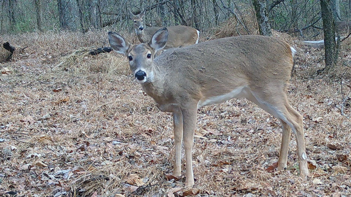
Seth Morelock, in SIU’s doctoral zoology program, is teaming up with the Illinois Department of Natural Resources (IDNR) to test three methods for determining deer density, including the use of trail cameras. (Below) Toqi Tahamid Sarker and Taminul Islam, both pursuing doctoral degrees in computer science, developed AI models to sort through trail and thermal camera photos and count the deer in the image as well as their distance from the camera. (Photos provided by Seth Morelock and Toqi Tahamid Sarker).
October 12, 2026
SIU zoology, computer science researchers team up for IDNR deer density study
CARBONDALE, Ill. — White-tailed deer are a staple of Southern Illinois culture. Pope County celebrates with a festival dedicated to the animal, hunters of all ages skip school or work for the first day of bow or shotgun season, and some residents run seasonal taxidermy side businesses to create deer mounts, which end up lining the walls of homes as decorations.
People in the region don’t take deer population density for granted.
Now, Southern Illinois University Carbondale is helping the Illinois Department of Natural Resources (IDNR) by conducting a study on the best method to determine deer density. The research combines boots-on-the ground field work with the latest artificial intelligence (AI) applications.
Leading this research is graduate student Seth Morelock, who currently works in SIU’s Center for Wildlife Sustainability Research under the supervision of associate professors Guillaume Bastille-Rousseau and Brent Pease. Morelock grew up hunting white-tailed deer in Kingsport, Tennessee. As a child, he learned about the consequences of overharvesting as white-tailed deer nearly became extinct in east Tennessee. In the 1970s, the Tennessee Wildlife Agency began to relocate deer to that region and surrounding areas, where the animals are monitored and thrive today.
“My grandfather never had the chance to hunt because deer populations were extremely low,” Morelock said. “When white-tailed deer were reintroduced to east Tennessee, my dad learned how to hunt on his own. My dad taught me how to hunt. I harvest with a bow and rifle, but the bow takes a lot of trial and error and is more challenging.”
His respect for hunting and wildlife motivated him to pursue a doctoral degree in zoology at SIU after he found the opportunity to participate in this deer project.
Tracking white-tailed deer
Morelock is tasked with answering a very important question for the IDNR – what method is the best to determine the number of deer in a given landscape?
“There are tons of different methods out there, so it can be cumbersome in a way to pick and choose what method to use,” he said. “The findings will be used for the agency to obtain the best data upon which to base management decisions such as harvest limits.”
Too many deer can lead to concerns surrounding crop damage and increased vehicle-deer crashes, while too few deer can have ecological consequences, Morelock explained. One way IDNR aims to keep the deer population at a sustainable level is through setting county-wide harvest quotas.
The study has narrowed down three different methods for comparison – trail cameras, vehicle surveys using thermal imagery and drones. Morelock is analyzing each of the three methods in terms of logistics, cost and accuracy.
- Trail cameras: Only require initial set up, but researchers must sift through hundreds of photos, which can be time consuming.
- Vehicle surveys using thermal images: Requires a worker to be on-site, but data collection is limited to the deer that can be observed from the roadway.
- Drones: Requires a worker to be on-site, but it’s safer than previous aerial surveys using planes and helicopters.
In the fall of 2025, Morelock began using these techniques at sites across the state including SIU’s Touch of Nature Outdoor Education Center, the Shawnee National Forest, Wolf Creek State Park, Eagle Creek State Park and Moraine Hills State Park. These sites represent different types of terrain and geographic areas within the state.
“It can be challenging to find locations that can accommodate the trail cameras, vehicle surveys and drones,” Morelock said. “As a researcher, we want to have that consistency across all sites where we can compare the methods or else it can complicate the analysis.”
Artificial Intelligence helps with accuracy
Morelock has teamed up with two SIU graduate students, both working in the BASE lab under the School of Computing’s Associate Professor Khaled Ahmed and pursuing doctoral degrees in computer science. The duo trained AI models to help analyze images from the trail and thermal cameras.
Toqi Tahamid Sarker designed a program that can determine the distance of a deer in relation to a trail camera. It starts with Morelock physically planting flags at the trail camera site – a left row, middle row and a right row. Each row has 15 flags that are spaced one meter apart and are numbered. Overall, each site utilizes around 30 trail cameras, helping to increase accuracy.
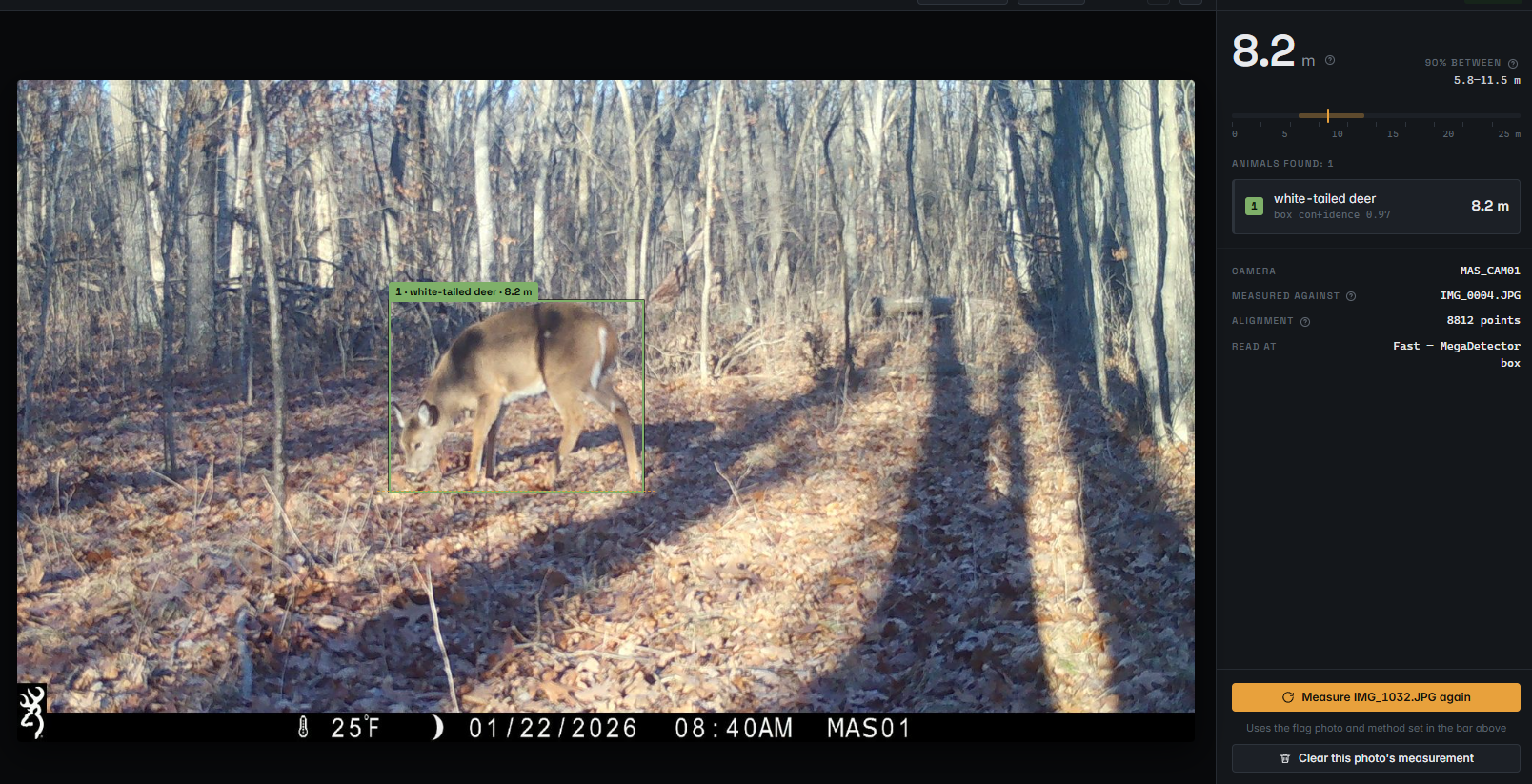 Sarker then inputs the image from the trail camera with the flag markers into the AI model along with an image from the same trail camera with deer in it. From there, the AI model can output the deer’s distance. While other AI models have already been developed to estimate distances, Sarker found his to be more precise.
“I found existing AI models are usually off by a few meters,” he said. “This model is off by one meter or less on average, so it’s fairly accurate.”
In addition, Sarker has added an extra tool to his AI model – it will provide an approximate range of how far the deer is standing with a percentage of confidence. For example, in the photo below, the AI model showed a deer in the photo stood 8.2 meters away from the trail camera and had 90% confidence the deer stood in a range between 5.8 and 11.5 meters.
Meanwhile, Taminul Islam worked on developing an AI model that can sift through thermal images collected during vehicle surveys to determine if deer are present in the photo and count the number of deer in the image.
“We found that other researchers who developed similar AI models did not consider that the application might overcount or recount the deer as the animal moves and is captured in different positions from frame to frame,” he said. “To solve this problem, we gave each deer an ID number so that when it appears in future frames, it’s not overcounted or recounted.”
His AI model is 98% accurate at detecting deer in a thermal image and 63% accurate at counting the number of deer in the image. Currently, Islam is working to feed the AI model additional images, so it can have an easier time identifying a blurry image of a deer or separately counting two or more deer that overlap.
Sarker and Islam’s work is already gaining some international attention. The graduate students put their findings in an academic paper, which was accepted to the Computer Vision for Ecology (CV4E) workshop at the European Conference on Computer Vision 2026 in Malmö, Sweden, on Sept. 8-12.
Scouting for additional data
Going forward, Morelock plans to conduct more surveys at sites across the state, including the Mississippi Palisades State Park near the Quad Cities. He’ll provide additional trail camera and thermal images to Sarker and Islam to expand their data set and improve accuracy.
Then, the next step includes collaboration between the BASE lab and Center for Wildlife Sustainability Research, focusing on AI-driven analysis of wildlife imagery for detection, population estimation and ecological monitoring. The team will evaluate methods across diverse habitats and accessibility issues.
While it’s too early for any preliminary findings, Morelock believes each method is promising in its own way, “Our findings may not result into one method that’s beneficial, and it might be that methods are very site specific.”