March 10, 2006
Mapping project will aid River to River runners
CARBONDALE, Ill. — In the beginning, organizers of Southern Illinois' annual River to River Relay road race mapped out the course with what race coordinator Keith M. McQuarrie described as a "highly calibrated Toyota measuring instrument" — they drove the course and looked at the odometer.
The course profile now being created by Southern Illinois University Carbondale engineering students relies on a purple Chevy Blazer and state-of-the-art global positioning system equipment to produce a map not only of the distances but of the hills and valleys that make this 80-mile relay the grueling challenge that it is.
Media Advisory
Reporters interested in contacting Allred about the map project as a sidebar for possible River to River coverage may reach him on his cell phone at 618/201-5984.
"They wanted a more accurate map than what they have," said Kory J. Allred, a second-year master's student in civil engineering who is overseeing the project.
"In most cases, we can get down to less than 6 inches."
Held each spring for the last 19 years, the River to River Relay draws hundreds of runners who run the course in eight-member teams. (Last year's race included Gov. Rod Blagojevich.) While some teams run simply for the fun of it, others are fiercely competitive.
"They want to know exactly how far things are, exactly what the elevations are so they can look at the people on their teams in terms of who can run the hills, who can run the distances," said McQuarrie, who has served as coordinator for the last 11 years.
SIUC students preparing for careers in surveying have done projects like this one — for free — since 1990, said Roy Frank, a licensed surveyor who has taught at SIUC for 25 years.
"It gives the students tremendous field experience," he said.
"The newer ones get to operate the equipment we use very quickly, and as they progress, they get to run the projects — the planning aspects, the managing aspects, the creation of the final product. For the students, being able to solve these kinds of problems means they will do well. It's one of the reasons we have a waiting list (of employers) for our graduates."
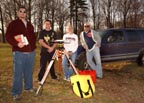
The mapping team consists of Allred, who hails from Tinley Park, and seniors Karen E. Mette of Dieterich, Travis J. Niederhofer of Hoyleton and Garrison T. Rule of Pinckneyville.
The students began working on the project early last November, searching out nearby control monuments (brass disks set in concrete 8 feet under the ground) where signals could give them the known coordinates and elevations they needed in plotting their map. They found five of the six, but none lay close enough to the course to be useful, so they had to make and install their own. They placed them within two miles of the roads the relay uses as its racecourse.
"We made around 20 monuments out of 1-foot rebar set flush with the ground," Allred said.
"They're good enough for what we're using them for now, though they may not be reliable in a year."
GPS work began in February. While two students set up a signaling base station at the nearest monument, Allred put the GPS receiver on top of his Blazer and then began driving the course at the breathtaking pace of 5 miles per hour. The system used signals from the monuments along with satellite signals to determine the Blazer's exact geographic location and elevation and every 100 feet recorded that information. While Allred drove, the third student sat in the passenger seat watching the data collector to make sure Allred didn't outrun the satellite. When he lost the signal from the base station, the two students there would move it to the next monument, and the process would start again.
As you might imagine, it's slow going.
"Time is our biggest challenge," Allred said shortly after they started this phase of the project.
"They (the race officials) want to have the maps before the race (which this year takes place April 22), we have to get it done before there's tree cover (which interferes with satellite signals), and I'm carrying a full course load and teaching three labs. My plan is to go out spring break if it's not done and work on it until it's finished."
Once they've finished gathering the positioning information, Allred reckons he needs a solid day's worth of computer work to churn all that data into recognizable, useful maps.
Despite the time investment, Allred said he'd found the project a rewarding one.
"Just getting started, I didn't realize how big a deal this race was," he said.
"It's kind of neat to be a part of it all."
Achieving excellence in undergraduate and graduate academics and serving others are among the goals of Southern at 150: Building Excellence Through Commitment, the blueprint the University is following as it approaches its 150th anniversary in 2019.

