
April 07, 2005
Study: St. Louis is the epicenter of flood plain encroachments
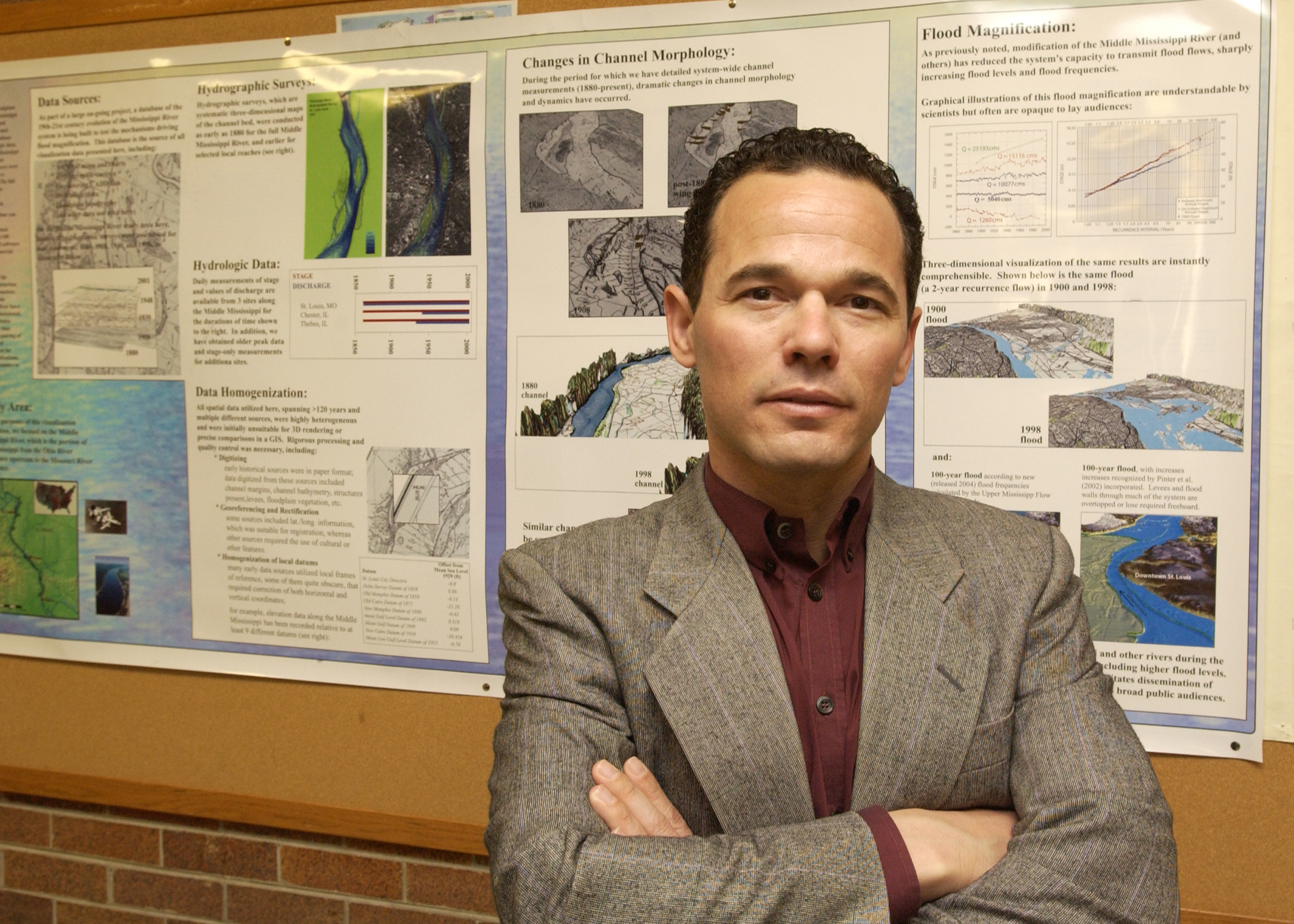
Caption follows story
"The St. Louis area is the epicenter of floodplain encroachment nationwide," said Nicholas M. Pinter, a geologist from Southern Illinois University Carbondale, whose article on the subject appears in this week's issue of the journal Science. "Because of the extent of human development on the floodplain, our research suggests that the next one may well be bigger than the last," he said.
"More than any other place, the greater St. Louis metropolitan area is allowing its floodplain to turn into new strip mall development. It has $2.2 billion in new development on land that was under water in 1993 — 18,000 acres either in construction behind levees or in the planning stages. It's just unprecedented."
Pinter has spent more than seven years examining flooding on the Mississippi River, the Missouri River, and other major rivers in the United States and around the world. To get a fix on floods along the middle Mississippi (from the spot just north of St. Louis where the Missouri River flows into it down south to Cairo, where it meets up with the Ohio River), Pinter and his students have analyzed the long and detailed measurement record from St. Louis and other locations.
"St. Louis is a wonderful place to do work," he said. "There are daily measurements of water levels from 1861 and scattered measurements that go back even further."
Statistical analysis of such measures as water height, flow and volume, land-use changes and channel width and depth reveals how river behavior — including flooding — changes over time and what has driven these changes.
"It's different from modeling studies that say what the river should do according to the model," he said. "We're looking at what the river actually has done — which sometimes conflicts with the results of the computer models."
Pinter has found, among other things, that floods happen more often and rise to greater heights when and where people build on floodplains and then construct levees to protect what they've built.
"Levees make floods higher when they come through because areas that would convey and disperse the flood flows are blocked," said Pinter.
Commonplace as levees along the middle Mississippi now seem, they're a relatively new landscape feature.
"Before 1900, there were very few levees in most areas," Pinter said. "For example, along a portion of the Mississippi floodplain in St. Charles County, there was only one low levee as recently as 1930, but by 2000, they're all over the place, and they're enormously higher — in some places as much as 10 times higher.
"The damage is ongoing. New levees are higher and enclose more land — a process that continues as we speak. When you look at what was there before (in terms of enclosed or raised floodplain), what's been added since 1993 and what's being proposed, it's just a huge amount."
For a few years after the Midwest's "Great Flood of '93," most everyone agreed that St. Louis area developers should avoid building on the floodplain, Pinter said. There was even talk of removing what was already there.
"The problem is that there are all kinds of incentives to build on that floodplain," he noted.
"It's available land, flat, and the pressures for economic gain seem to be winning."
This "rush into the floodplain" should serve as a wakeup call, both for the greater St. Louis area and other regions where this rush is occurring and for the rest of the country, Pinter said.
"We should pay attention, enforce the laws, not let these activities go on because we're going to pay a price for them — every taxpayer in the country will pay the price when a flood like the one in 1993 next comes through," he said.
"We have a golden opportunity to hold the line — to prevent these things from being built in the first place because it's a one-way process. Once they're built, FEMA (Federal Emergency Management Agency) will never be able to afford to remove them — there's not that much money in the buyout program, and there never will be."
In the meantime, business and property owners in the floodplains of St. Louis and St. Charles County should brace for the worst. Records show that the area's 10 highest floods in the historical record all occurred in the last 65 years.
"In any given year, you will have the same danger of flooding whether it's been 100 years since the last one or just last year — it's just a matter of time," Pinter said.
Leading in research, scholarly and creative activities is among the goals of Southern at 150: Building Excellence Through Commitment, the blueprint for the development of the University by the time it celebrates its 150th anniversary in 2019.
(Caption: Flooded with data — Geologist Nicholas M. Pinter of Southern Illinois University Carbondale stands next to a wall poster depicting flooding along the Mississippi River. Pinter reports in the journal Science that the St. Louis area is developing its floodplains at an unprecedented rate.)
Photo by Steve Buhman